Sunday, May 25, 2008

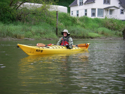
Tenasillahe Island May 2008


Date: 5/25/2008
Time on water: 12:40
Time off water: 15:50
Trip distance: 5.36 nm
max speed 5.5 kt
moving avg: 2.7 kt
moving time: 2 hrs


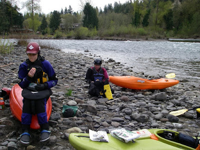
I took Stephanie to Skamokawa for a kayak class with Columbia River Kayaking. She had come to Alder Creek's PaddleFest in April and really enjoyed kayaking so wanted to take a class to build a good foundation for having fun and being safe kayaking. And depending on conditions I would find some fun place to paddle while she was taking the class.

Due to warm weather the week before and alot of recent rain the water level of the Columbia was pretty high. It rained for most of the drive up to Skamokawa, but soon after we got there the rain stopped. I introduced Stephanie to Ginni. It was good to see Ginni again. Back from Mexico she was nicely tanned :)

I helped Stephanie sort out a bit of gear and clothing and I looked at the water and the charts to figure out what I was going to do with the day. Though the water was high, it didn't look brown and churning. Low tide was appr 13:30, but the current was basically ebbing all the time I would be out. So I planned to paddle across the river to Welch Island and Tenasillahe Island. The idea was to allow the current to take me downstream a bit to the north end of Welch Island. Then I'd paddle upstream in the shallow water near the islands as far as I had time. Then back across the main channel to the Washington side where the current would be stronger and let that strong current take me back to Skamokawa.

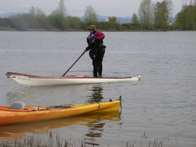
I got setup and headed out. Once I got into the shipping channel it was clear that there was alot of current. I basically followed my plan and ended up at the north end of Welch Island for lunch. Then paddled upstream, found the shallow water at the south end of Welch Island, crossed Red Slough over to Tenasillahe Island where I stopped for a hike on the trail around the perimeter of the island. I paddled a bit further south along Tenasillahe Island and headed back across the main channel. Once I'd crossed the shipping channel I turned downstream to enjoy the pretty strong current spiriting me back to Skamokawa.

Along the way I saw a few blue herons, alot of ospreys hunting, a bald eagle on Price Island eating something with a number of vultures hanging out nearby just waiting...

I got back to Skamokawa Center and found that Stephanie's class had just come ashore and were doing navigation stuff in the classroom. After her class, Stephanie and I headed over to the River Rat in Cathlamet to toast the day! It sounded like she had a great class and a good day on the water as well.

Hammersley Inlet to Hope Island


Date: 5/19/2008
Launch time: 12:30
Off water: 18:10
Distance 14.2 nm
Max speed: 7.8 kt
Moving avg: 4.0 kt
Moving time: 3:32

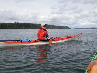
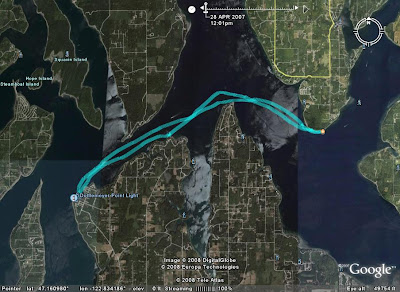
On an overcast Monday in May Ken and I paddled Hammersley Inlet. I was going to be up in Olympia working with him for a couple days so we decided to take part of Monday and go kayaking somewhere in his neck of the woods. I'd never done the classic Hammersley Inlet trip and the tides were favorable for it on Monday: low tide was appr 1pm. Our plan was to launch and land at Walker County Park near Shelton and paddle out to Hope Island for lunch.

We set out for Walker County Park and managed to get lost along the way. Note to self: always remember to bring the guidebook. The maps we had just weren't detailed enough to figure out how to get there. So we started a bit later than we'd hoped, but the tide was still ebbing and we got some nice help from it. I really enjoyed the Hammersley Inlet neighborhood. Kindof woodsy, some areas of nice older houses. I could picture living there, having a nice garden and doing some fishing.

As we got out into Pickering Passage the tide was just starting to flood and Ken wondered if there might be a nice little tide race off Steamboat Island which was on our way to Hope Island. It turns out there was so we played on it for a few minutes til the rising tide flooded the feature.

We then paddled over to Hope Island for lunch. Took a walk around the island. I could be a settler there. Nice afternoon. After lunch we completed our circumnavigation of Hope Island and headed back.

When we back into Hammersley Inlet the flood was really going, especially near Cape Horn. I got up to 7.8 kt! It was pretty swirly too. But pretty fun. On the return trip I really enjoyed the scenery in Hammersley Inlet. I could live there.

Got back to Walker County Park just as it was starting to rain. A good day out.

Tuesday, April 22, 2008

Clackamas River: Barton to Carver


On a cold Sunday in April we did a whitewater kayak voyage from Barton to Carver on the Clackamas River. Alder Creek was doing one of their Fundementals of Whitewater Kayaking classes and Katlyn and I tagged along as alumni on the river run day of the class (Sunday).

Both of us needed to get back in the whitewater kayak saddle. The last time we had been out on whitewater was December '07. The plan was to go out in late April because it would be warmer than winter. Well, nice plan. Turns out this weekend we had freak cold weather. Snow and sleet around Oregon and Washington. It was cold! The water was really cold. Much of our day out it altnerated between a really cold rain and sleet. Drysuits are truly a gift from the gods. Or from Kokatat at least :)

It turned out to be a good group. The Alder Creek coaches were Paul, Annette and Shawn. There were five students in the class, and two alumni (Katlyn and I). Can't remember all the students' names. A few were Marin (sp?), Jo, Kevin, and Chris. All good folks to hang out with.

Neither Katlyn or I had been whitewater kayaking since December. She did pretty well. I was definitely feeling rusty. So it was good to get out. I was paddling much better by the end of the day. But at first, not so much. And early on my roll sucked -- I was definitely shocked at how cold the water was so tried to roll before getting setup properly. I (almost) always got it on my second try. But in one rapid I was doing great, then slipped up in some way and I was just over instantly. I again was too hasty in my roll attempt and it didn't work. As I was taking my time getting setup for my second attempt I ended up in fast moving water about six inches deep moving across a shelf of very slick clay. So I was dragged along for awhile before the water got deep again, the result being that one side of my drysuit was caked in clay. Katlyn thought this was hilarious. I'm glad I was able to provide some entertainment value.

Then after lunch the sun came baking down. At this point in the trip we were often just in deep water. I took a good bit of time practicing my rolls in various situations, got used to the cold water, and got it back. So yep, practice, a good thing.

The water was bigger and much more swirly than when we were out in December. Of the non-instructors, almost everyone went over a number of times. But folks were in general doing pretty well. And when they went over most requested an Eskimo rescue and it worked. Katlyn did well. She was just calm, had this great upright seated position and nice strokes, and loved the rapids. Never once went over unintentionally. Her only problem was that her hands were very cold alot of the day. Understandable. The instructors congratulated her for coming out in the snow in December and the sleet today and promised her that her efforts would be rewarded by great days paddling in the sun in July.

Date: Sunday April 20, 2008
Distance: appr 5.25 mi
Class II
Appr 2900 cfs (at Estacada)

Tuesday, April 15, 2008

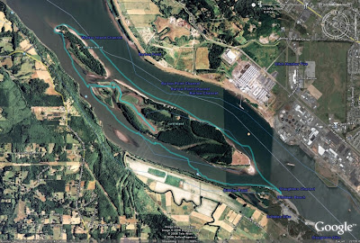
Circumnavigation of Lord and Walker Islands


On a pleasant Sunday in mid-April an intrepid band of OOPS paddlers kayaked around Lord and Walker Islands (in the Columbia River near Longview).

This was an OOPS trip. Joanne Barta organized the trip and was one of the leaders. Don Beale and Ken Durbin were co-leaders. There were 11 of us total. The plan was to meet at Dibblee Beach on the Oregon side of the Columbia River at 9am and be on the water by 10am, paddle downstream in the main channel taking advantage of the current, have lunch at the north end of Walker Island, and return to Dibblee Beach upstream via the slough on the Oregon side. High tide in Longview was at appr 9:40 and the next low tide was at appr 18:40, so we'd be paddling on an ebb the entire trip.

The weather prediction was chance of showers, winds W - NW 7 - 10 mph.

After everyone got their gear ready and we talked about the plan for the day and safety we got on the water at 10:10.

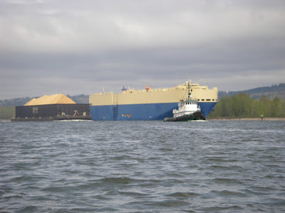
The day started off overcast and cool, with very little wind, but it looked like we could get some showers. We headed out into the main channel of the Columbia and it was easy paddling with the current. We watched a freighter pass a tug pulling a barge. Looked like a very slow-motion drag race.


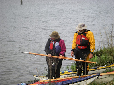
The day had warmed up a bit by the time we stopped for lunch at the north end of Walker Island. We had a very nice lunch stop. We even had entertainment! Joanne was practicing throwing her harpoon and then giving others who wanted to try it a bit of instruction.


After lunch we meandered in the wetlands of Lord Island. Very pleasant paddling. We saw eagles, ospreys, geese and lots of different ducks. We stopped for a bit to stretch our legs and Joanne and Don showed us that you don't need to be near dry land to do that!


The paddle back to Dibblee Beach gave us a nice bit of exercise paddling upstream. That promised west wind never did really get very strong so not much wave action at all. Since the day was so nice we took some time to practice towing. The water was still pretty cold so folks weren't too enthusiastic about practicing rescues quite yet :) But some of us did practice our rolls just before getting back to the beach. And it never did end up raining :)

All in all a very pleasant day paddling and hanging out with a good group of folks.

Date: 4/13/2008
On the water: 10:10
Off the water: 15:40
Total: 9.9 nm

(Click on any of the photos for larger versions.)

Friday, April 11, 2008

Boston Harbor to Devils Head


On a chilly Tuesday in early April, Ken and I paddled from Boston Harbor to Devils Head and back.

I hadn't been paddling in the South Sound in some years and Ken had been wanting to take me out kayaking there and show me his neighborhood. Ken lives in Olympia and so knows many of the little nooks and crannies of the many and various arms of the southern part of Puget Sound. I'd read about many of these areas for paddling in Washburne's book "Kayak trips in Puget Sound and the San Juan Islands", but had only paddled once in the Nisqually Delta. And that was some years ago.

Given the tides and the time we had, Ken chose a trip starting from Boston Harbor, just north of Olympia, to Devils Head and back. The plan was: The tide was ebbing so the current would help us going east to Devils Head. We would have lunch at Devils Head. Slack was at appr 14:15. We would return to Boston Harbor with the help of the flood current. Sounded good to me!

We got on the water at appr 12:30. It was cool, with just a bit of a breeze from the south. As we went through Dana Passage we could really feel the ebb current. Ken told me that on the flood if there's a west wind opposing it you can get some steep waves there. We got hungry well before Devils Head so stopped at Dickenson Point for lunch. Lots of mussels and sea anemonies on the rocks. Lots of goeduck clams sticking there necks out in the shallow nearly-low-tide water. It was cool but sunny at lunchtime.

We got back on the water and headed east toward Devils Head. Got a bit of a south wind as we crossed the mouth of Henderson Inlet and a bit of wind waves.

The wind subsided as we approached Devils Head and we had a lovely paddle in that area. Stopped for a rest on the beach. Then as we saw dark clouds to our south and east we decided to head back. The flood current was definitely helping us. But then we got into a small squall with a bit of rain and appr 12 kt west wind in Dana Passage. And yes, we got those steep waves. Not too big -- appr 1.5 ft. But it was work paddling against the wind. But as Ken noted, paddling against the wind gives you a good opportunity to work on your forward stroke. Since your forward progress is slowed way down you can focus on each aspect of the stroke, like, well, in slow-motion.

But then the wind subsided, we still had a nice flood current, and we were cruising along at over 6 kt! We got a bit of tidal race action in Dana Passage which was lots of fun.

Then we turned south to get back to Boston Harbor and all was calm again. A very nice day on the water.

Date: 4/8/08
Total: 14.2 nm

Thursday, April 10, 2008

Scappose Bay


On a mild Saturday in late March, Kristin and I explored the Scappoose Bay waters. Our goal was to get out and do some mellow wetland paddling. Due to time constraints we also needed somewhere relatively close to town so we chose Scappose Bay.

We put in at the Scappose Bay Marina about two hours before low tide. Since the water was ebbing, we first paddled out of Scappoose Bay, across Multnomah Channel, and up the little river flowing out of Sauvie Island across from Scappoose Bay. Then, as the tide was beginning to flood, we paddled back in to Scappoose Bay to explore its wetlands as they filled with water.

Well, they weren't filling up very fast so we found ourselves paddling in about 12 inches of water alot of the time. We were thus thankful we were paddling kayaks. It was a beautiful spring wetland paddle where we saw alot of birdlife: geese, including some beautiful white ones, ducks, herons, etc. And we startled alot of carp in the shallow water.

Date: March 22, 2008
Appr 8.5 miles.

Sunday, March 9, 2008

Bonneville Dam to Washougal


Well, another sunny day paddling with Jon Walpole and friends.

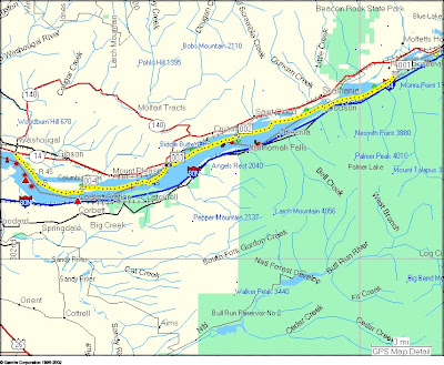
Jon was looking for a nice kayak trip for this Sunday. The Columbia Gorge was an option. The weather prediction for today in the Columbia Gorge was for E winds 11-17, gusting to 25 (mph). 20% chance of rain. Though the tidal influence at Bonneville is small, the tide would be ebbing all the time we'd be paddling. (High tide Vancouver: 9:23am, low 17:39.) Not bad. So he planned a trip from Bonneville Dam to Washougal. I'd never paddled that part of the Columbia so I was definitely up for it.

Jon, Jenny and I met at Steamboat Landing in Washougal at 9am (a civilized time - I'd even had time for coffee and breakfast). We took Jon's car up to the boat ramp on Hamilton Island for our launch. As we drove to the boat ramp we got an awe-inspiring view of massive amounts of water coming over the Bonneville Dam spillway. Now, I'd never been to this spot... but the boat ramp seemed awfully close to the dam's spillway if you ask me. And the really big red sign just a few feet east of the boat ramp that said something like "Danger - Do not proceed past this point" also was pause for reflection. Still, we got gear situated, did warm up exercises, etc. As we were getting ready pair of bald eagles flew by. A good omen to be sure.

The boat ramp itself runs into a little eddy. We launched, and leaving the eddy into the main channel turned out to be a very pleasant little bit of acceleration to start our voyage and not the Deception Pass eddy peel-out I was expecting. We got on the water at 10:20.

On the chart it's clear that the Columbia is pretty narrow at that point, but it was striking to actually be there. It really feels narrow. And alot of water moving. We were paddling gently yet cruising along at a nice rate of knots. In that area of strong current we were often going 10 mph: 8.7 kt! I was thrilled.

We did a bit of eddy play here and there. Some impressive eddylines. Not Deception Pass, but alot more conveniently located!

Of course the river soon widened and the current slowed to pretty much what you'd expect -- appr. 2 kt. We got more current here and there, but never got going that fast again on this voyage.

During the early part of the trip there was next to no wind. So the current was a great help. After awhile the wind picked up, but it never got to the promised 17 mph and I'm sure I never felt a 25 mph gust. But the wind did pick up to appr 15 mph and we got some small waves. These small waves were great for practice. Trying to eek as much energetic help from them as I could. And lots of opportunities for really working on getting my speed right for catching a wave, stern rudder, etc.

We stopped for lunch on Skamania Island. Jon and I told Jenny stories about hiking and climbing in Scotland. The sun baking down :)

After lunch the 15 mph E wind was still helping us. We continued to work on catching those small waves. We planned to pull into the eddy behind Phoca Rock to relax. But as we approached we saw that there were at least ten sea lions hauled out on the rock. As we passed they clearly weren't happy with us. My they can be noisy! And big! And about the time we were going to pull into the eddy behind Phoca Rock the all jumped into the water. I was sure they were heading for us! So... we didn't pause there. Where are the orcas when you need 'em?

We meandered at the base of some beautiful basalt cliffs at Cape Horn. Some nice waterfalls. Some nice spots to play among the rocks.

We did pause for a break at the east end of Reed Island. Then off for the final bit back to Steamboat Landing. As we neared Washougal the wind died completely and it felt like summer. We made use of the calm water to practice paddling in reverse for awhile. Always good to do.

Then were were back just before 4pm. A total of 19.33 nm -- 22.3 miles! Our moving average speed was 4.2 kt across the entire day. Max speed: 9.7 kt :) Moving time: 4hr 32min.

Easily the most distance I've ever covered paddling on a day trip. And I felt great at the end of the day. I've definitely had days when I was much more tired after not covering as much distance - like every BCU 4 star training I've had the good fortune to take (a heartfelt thank-you to Shawna and Leon and Karl and John Wallum).

What a great day. We had beautiful weather. Great company. The current helped us out. We saw eagles and a falcon of some variety. More sea lions that I'd care to.

But bittersweet at the end... got back to the car and had a voice message from my Uncle Lou's partner. My Uncle Lou, a fellow kayaker, is in his 80's and has been getting alot weaker lately. His partner phoned to tell me he's not likely to live to the end of the month. His heart is just giving out. He hasn't been out kayaking in some years now, but was very encouraging when I took it up and has enjoyed my trip reports. He always wants more details when we talk on the phone. I know we all get old, but I will miss him.

As usual, click the picture below for more pictures. Jenny took most of the good ones!