Showing posts with label Columbia. Show all posts

Sunday, April 19, 2009

Mayer Park to Klickitat

From klickitat_apr09


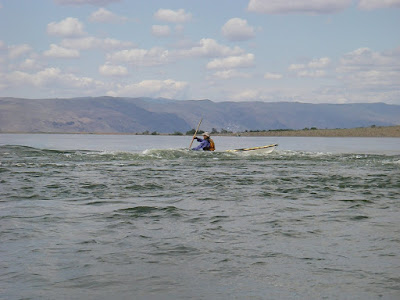
It felt like summer. We were out on the Columbia and Klickitat Rivers today between Hood River and The Dalles. Sunny, about 80 degrees. It felt great.

Neil and Tom organized this OOPS trip. The plan was to put in at Mayer State Park near Rowena Oregon (near The Dalles) and paddle across the Columbia to the Klickitat, up the Klickitat to the first few rapids and play there til the afternoon west wind built up in the Gorge. Then return to the Columbia and surf the wind waves back to Mayer Park.

Well, by this morning it was pretty clear that the typical west wind was not going to materialize today. So Neil suggested we just spend the day playing in the moving water at the first few rapids on the Klickitat. Practicing peeling out of eddies, ferry gliding, etc.

It was a beautiful day. Sunny, blue skies. No wind.

There were eight of us total. Neil and Tom, Bob, Jay (another one), Ken Scholtz, Dave and Karen Dalbey and me. We got on the water a bit after 10am and paddled across the Columbia to the mouth of the Klickitat and headed upstream. I mentioned to Karen "Hey, this paddling upstream isn't bad". She noted that I probably shouldn't have said that...

We got up to the first fast water and all put our helmets on. Played for awhile in the first eddy and eddyline. Then worked to get up to the next eddy. Felt like work at the time anyway. We played on that eddyline a bit as well. There was a nice beach above the fast water and Neil worked pretty hard and took a fair while get to it. Looked like alot of work. Then Tom informed us that that was our intended lunch spot. And if we didn't get there we couldn't eat :) Great motivational speaker.

Dave Dalbey went for it and got there pretty handily. Looked like the key was to have alot of speed crossing the eddline and cross the eddyline to ferry across rather than turn in any way downstream.

I went for it. I had good speed crossing the eddyline and ferried to the other side fairly easily. Then got bogged down in the fast current near the rocks on the other side. Just couldn't make any progress. I was out of energy when Neil pointed out a little eddy I could rest in. Got it. Rested a minute then pulled hard for the last 20 or 30 yards to the beach. That was exercise. I was tired and ready for lunch!

That beach was a great spot for lunch.

After lunch most folks went up to the next set of rapids. I was enjoying the beach alot so napped a bit. Once they all came back we played for quite awhile in the current near our lunch beach. I hadn't been in current in a sea kayak since last summer so it was great to get the practice. And nice to do it on such a warm day so if one dumped ones boat the water felt great. Most folks were rolling periodically just to keep cool.

Finally we headed back. We floated lazily down the last bit of the Klickitat down to the Columbia. The area is just beautiful this time of year. Still green and fresh with spring. Lots of flowers. Hawks and eagles and osprey, oh my. I saw a nice steelhead jump a couple times.

Got back to the Columbia and as expected no wind. But it was a pleasant paddle upstream the short ways back to Mayer State Park. A good group of folks and a good day on the water.

Sunday, March 29, 2009

Dalton Point to Chinook Landing

From DaltonPoint_090329


On a gray and sleety morning in late March an intrepid band of OOPS kayakers launched from Dalton Point on the Oregon side of the Columbia (near Multnomah Falls) headed toward Chinook Landing (near Fairview, Oregon).

Tom Argent and Neil Schulman did a great job of organizing this trip. There were eight of us altogether: Tom, Neil, Mike, Bob, Kevin, Becky, Stacy and myself. We met and Chinook Landing and did all the shuttle stuff to get us and boats up to Dalton Point. We launched at appr 10am and paddled across to Phoca Rock. We explored around it a bit, then headed over to Cape Horn on the Washington side and really enjoyed exploring that area. The cliffs and waterfalls there were beautiful.

As we left Cape Horn and headed west we got a bit of west wind, but not much. Maybe 8 mph. Sometimes it was there, sometimes not, til we got to Reed Island.

We paddled on the north side of Reed Island to find a lunch spot. No wind at all on that side. By now it was warm and sunny. A very relaxing lunch.

After lunch we headed to the west end of Reed Island then threaded our way through the maze of drift nets. I find it hard to believe that commercial salmon fishing with nets is still allowed in the Columbia given the precarious state of these salmon runs. Sure, commercial salmon fishing in Alaska still makes sense. But not on the Columbia. With millions of people out of work in this country it's impossible to justify keeping a couple thousand fishing jobs (at most) that threaten these fish with extinction. People will live. Extinction is forever.

But eventually we crossed the Columbia and paddled behind Gary Island, then along the outside edge of the Sandy River Delta. While paddling in that shallow brush-filled water a large carp hurled itself at Stacy's boat. It made a "twack!" that was audible for quite a ways and a nice large splash! That really got her attention :) Just like the carp Kristin and I encountered in Scappoose Bay.

From there it was on to a few large rocks (with power pylons on them) at Troutdale. We found a nice eddyline coming off one of those rocks and stopped there to play for awhile. A nice warm day, a fun little eddyline... life is good.

But eventually it's time for all of us to get home so we headed west the now short distance back to Chinook Landing. We landed at appr 17:00.

According to Mike's trusty GPS: 17.7 miles. A good day on the water.
From DaltonPoint_090329

Friday, February 20, 2009

Valentine's vacation at the beach

From Nahcotta


Kristin and I had both been working alot lately and she had some vacation time she had to use (use it or lose it). We wanted to get out into nature, do some paddling, and eat healthy food to rejuvenate ourselves. But we couldn't afford to go too far. So we decided to head to the Long Beach Peninsula for a few days.

We headed out on Sunday Feb 15 after Valentine's Day, pointing the car in the direction of Astoria. We stopped for a nice paddle from Knappa on the way.

From Nahcotta


That was about 5.4 miles.

Definitely enough so we were ready for dinner! In Astoria we stayed at Clemintine's B&B, which was lovely. We showered and headed to Baked Alaska for dinner -- the first of our seafood dinners of the trip. So far, the trip was going according to plan: nature, exercise, healthy food. I love it when a plan comes together.

The next day we had a nice breakfast at the B&B and then meandered around Astoria in the morning. I'd been to Astoria a couple times in the past year or so in the course of several kayak trainings, but had never explored the town. At those classes we always did our wrapup at the Fort George Brewery, which is a great way to wrapup a kayaking day. (Well, not always... on our night navigation class last summer that went from Aldrich Point to Astoria we didn't get to Astoria til after 2am, at which time the pub was closed. I really could have used a beer about then too.)

So on this sunny February day Kristin and I wandered the town and toured the Flavel Museum -- very worthwhile. And hit up the Blue Scorcher Bakery for bread for the trip.

We then got in the car and headed north. Stopped in Ilwaco for lunch -- more seafood! Then bought fresh seafood from a local market to cook at our cabin for the next couple days.

We stayed at Shakti Cove Cabins, which are very peaceful. Just the kind of relaxing setting we needed. Kristin made a great dinner of prawns and sole.

We wanted to paddle Willapa Bay. We'd never done that. But on the days of our trip the tides were not in our favor. High tides at about 7 am. Low tides were about 1 - 2 pm. And Willapa Bay has lots of mudflats at low tide. Very easy for boats to get stranded in the mud til the tide comes back up. But if you stay in the narrow channels that are deeper, the current can be very strong, sweeping you out toward the bar, and you really don't want to go there.

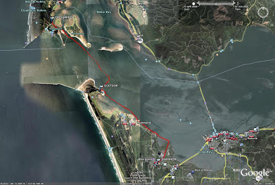
So we got out on the water early on Tuesday morning to avoid low tide. Put in at Nahcotta. And paddled east to Long Island. Take a look at the GPS track of that trip and you'll see that the ebb did push us a bit north at first til we figured out how strong it was.

There was still plenty of water when we got to the island. Nice river rock beach. Yeah! We walked around on the island for awhile. Lots of elk tracks. But didn't want to stay long since the tide was ebbing. By the time we left the boats were high and dry. We had to carry them across a good bit of mud to get back to the water.

Our plan was to paddle south against the ebb in the shallow water near Long Island to avoid the strong ebb current in the channel, then head west across the channel and let the ebb take us back to Nahcotta. And our plan worked. We had an amazingly calm February day. We took advantage of the beautiful weather to practice technique in the clear shallow water near Nahcotta. Yep, saw lots of oysters.

Trip: 6.45 mi.

We were back to Nahcotta about noon. So we relaxed, walked around Ocean Park and the beach there, and Kristin made another great dinner. This time fresh crab and greens. Yep, more healthy local food :)

From Nahcotta

Friday, December 12, 2008

Skamokawa Center Farewell

From Skamokawa_081211


From Skamokawa_081211


I was very sad to hear that Skamokawa Center was going bankrupt. I really like all the people there. It's such a great spot to start a kayaking trip. You can do such a variety of interesting trips from there. Lots of great wetland trips on the sloughs. Much more open water trips on the Columbia. Journeys like paddling from Skamokawa to Astoria.

So the day before they closed I went down there to paddle from their dock one last time. The tide was flooding in the morning and would start to ebb about 1pm. So I headed toward Cathlamet and turned around with the ebb. I took a break on the beach just NW of Hunting Island.

It turned out to be a beautiful winter day. For awhile I had an east wind of maybe 5 or 6 mph that helped me (ever so slightly) paddle back to Skamokawa.

Once I got back, the folks at Skamokawa Center fed me freshly baked cookies. Yum...

I wish I had the wealth to buy the place. It already has a good team to keep it running. Just needs a bit more marketing to get a few more kayakers coming up there. I could live there and retire there!

From Skamokawa_081211

Saturday, June 28, 2008

Ilwaco to Warrenton


The last weekend of June 2008 John Sindelar and I took a Dynamic Water Workshop with Ginni.

On Friday June 27 we focused on surf and swell practice on the Pacific side of Cape Disappointment State Park at Benson Beach. It was definitely the largest surf I had ever paddled in. My guess: 5 - 6 foot waves. Ginni... what was it actually? Turns out I'm not in good enough shape to paddle out through the surf many times so while John was surfing in and paddling back out I stayed out beyond the surf in the swell with Ginni and we worked on paddling skills in the swell. It was a nice 3 - 4 foot swell, which was perfect for me to practice edging, turning, paddling backwards, etc. When I did surf in, I felt pretty good. I managed to paddle backwards hard several times to allow waves to pass under my boat that I didn't want to surf. I surfed some smaller waves and had lots of fun. And I was thrilled that when I dumped my boat a couple times each time my roll worked! I didn't come out of my boat the entire day.

The wind really kicked up in the afternoon so after lunch we went over to Waikiki Beach in search of less wind to do a little rock gardening. But it was still pretty windy there -- appr 25 kt north wind. I went out a little, but not very far.

The wind for Saturday was also predicted to be strong: N 20 - 30 kt. So that evening we were all sitting in the Sea Hag bar in Ilwaco with charts spread across a table trying to figure out what kind of trip we could do on Saturday to give us good "learning" situations but still be survivable. That was the trip planning part of the class. We studied the charts, checked the tide and weather predictions, detailed the hazards, and compared what we wanted to work on with what was doable. We decided that we'd do a journey, paddling from Ilwaco across the mouth of the Columbia River to Astoria. During the time we'd be paddling there would be a fair bit of current, but the wind from the NW would way more than overcome that. So the plan was we'd be surfing wind waves to Oregon. Way fun and great learning. As a backup we would leave a car in Warrenton at the Skipanon Marina in case we didn't want to paddle across the mouth of Youngs Bay all the way to Astoria.

So Saturday morning rolls around, we do a car shuttle to leave a car in Astoria and Warrenton and drive back to Ilwaco. During the drive we notice that it's not windy at all yet. Fine so far. Then we launch our kayaks at the boat launch in Cape Disappointment State Park (near downtown Ilwaco) and set out toward Oregon. Still no wind. That's ok. We got to the south end of Sand Island and started to feel the beginning of the ebb. Still no wind.

We were seeing all kinds of birds by now. Lots of pelicans, gulls, terns. Ginni gave us much detailed information on the terns.

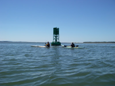
Our plan was to have lunch at the marina in Hammond. We headed toward Buoy 21 to get there. We encountered more ebb current and still no wind at our backs. And the sun is baking down on us as we paddle against the current. For a couple hours. During this segment of our fun filled journey I was consistently falling behind. I hate to hold up a group. I was not happy. It was very difficult for me to maintain the paddling pace to keep up with the group. So it became clear that the key thing I need to work on now to be a better paddler is just to get in better shape. Ginni was very helpful with tips on forward stroke and we paddled in line so I could draft off the others.

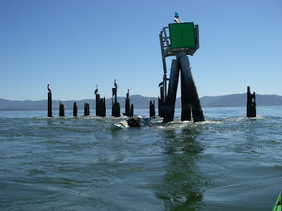
We got to Buoy 21 and the beach on Clatsop Spit in Fort Stevens State Park looked very close. We decided to have lunch there instead of Hammond. We took a few photos and were off.


We made it across the Columbia and stopped on the beach at the NE tip of Clatsop Spit (nearest spot to Buoy 21) for lunch. As we got to the beach there were plenty of people in swimsuits enjoying the hot Saturday afternoon. John and I peeled the top of drysuits off our bodies to cool off a bit. Lunch was great.

Finally the wind picked up from the NW. And we were off again, heading SE toward Astoria with the wind at our backs and moving along nicely with very little effort. Finally we were cruising along at 4.5 kt :)

But the wind died down after about an hour and the rest of the trip was just paddling upstream. We stayed near the shore to be in minimal current and found a few eddies as well. I was getting pretty tired so we ended the trip at the Skipanon Marina.

We did a bit of car shuttle to get the boats back to Ilwaco, discussed the day, and I headed home. As I was driving across the bridge to Astoria I noticed a brisk west wind had developed.

Though I was pretty tired, it was a good paddle trip for me -- I'd never crossed the mouth of the Columbia via kayak before! Definitely an achievement.

Date: 6/28/06
Launch time: 10:00
At south end of Sand Island: 10:54
Lunch on shore: 12:45
Launch after lunch: 14:00
Off the water: 16:00
Distance: 11.4 nm
Avg speed: 2.3 kt
Max speed: 5.6 kt
Moving time: 5 hrs


CurrentSand IslandHammond
Slack10:2210:21
Max Ebb12:0012:47
Slack16:0016:20


Monday, June 2, 2008

Hanford Reach June 1 2008


On a beautiful Eastern Washington sunny Sunday a group of OOPS paddlers kayaked part of the Hanford Reach of the Columbia River. This was a scheduled OOPS trip led by Pat Daly and co-led by Tim Mattson and Don Beale. The rest of us paddlers were: Dave Beckett, Frank Blangeard, Jay Buckingham, Ed Kraft and Greg (didn't catch his last name).

I'd heard about the Hanford Reach of the Columbia for years. The last free-flowing non-tidal stretch of the Columbia in this country. Pretty much undeveloped due to it being a restricted area since the 1940's. Well, except for an old reactor here and there. Basically a wildlife refuge now. I've wanted to visit there for a long time. So when I saw that an OOPS trip was going there I was really excited. And I was thrilled when I heard that it was being led by Pat Daly, a guide who really knows the paddling in that area.

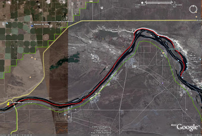
The plan was to launch near Vernita Bridge (where Washington Highway 24 crosses the Columbia about 30 miles north of Richland). We would then paddle about 21 miles of the Hanford Reach and take out at the White Bluffs boat ramp.

We met at the beach on the north side of the river just west of Vernita Bridge, got boats and gear situated, then did the car shuttle to the take-out. We got on the water about 11am.


The water was pretty high (not surprisingly), running at appr 200,000 cfs. So once we got paddling we were moving -- soon about 6 - 7 kt. Though there was alot of water, it looked pretty clean to me. Often a few upwellings here and there. And some nice crisp eddylines. With the current it was pretty easy paddling watching the scenery breeze by.

I borrowed a Greenland paddle from Don. I'd used one for the first time at OOPTIKS and really enjoyed it. Now I wanted to know how it would feel to use one on an all-day trip. Short story: I loved it.

After about 4.5 miles we got to Reactor B, the first of the large-scale plutonium production reactors. It's of course closed down now. The juxtaposition of the undeveloped desert landscape and these Cold War edifices was striking. Also striking was the wildlife. Since non-Hanford people are allowed on such a small fraction of the Hanford Reservation area, animals pretty much have it to themselves. We saw lots of deer, some otter, some large fish, and lots and lots of birds from hawks to geese to swallows.

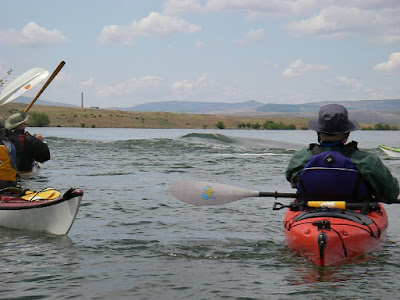
About 6 miles from the launch we got to Coyote Rapids. Pat described the rapid to us and we all decided that yes, it sounded like alot of fun. We were told that at typical flow levels it's not much of anything, but given the high water we had it might be fun. The rapid can be easily avoided by going river left, so of course we were all hugging river right. We got to a little riffle and Tim and Don stopped to play in it. Pat called them onward: "Hey, the real rapid is down there!" There hadn't been much life-threatening excitement thus far on the trip so they were taking advantage of every feature they could find. But when we got to the rapid... we were all impressed. A couple nice clean waves with some bouncier waves behind. And a nice big eddy on river right that allowed easy access to the rapid. Again and again :)


We played there for quite awhile. The Hanford folks could do great things with that location... I'm thinkin a little parking area, we don't need a fancy launch site, just put kayaks in using the river's beach either above the rapid or in the eddy, a nice cafe selling cappuccino and ice cream with a deck to watch the kayakers play in the rapid, a barbecue place and microbrewery, maybe some cabins and a B&B...

I went through the rapid four or five times. It was my first time working with strong current and rapids using a Greenland paddle. I was pretty happy with it. Bracing worked very well. Stern rudder worked well. Had a bit more trouble getting up to speed quickly. Once I managed to get across to the smooth waves and surfed for just a bit. I'm sure it wasn't very long, but it felt great. Anyway, I had a great time. I could have stayed there all day. Like Deception Pass, but with sunshine!

After the rapids we continued our fast and easy trip to our lunch spot. More wildlife, more sunshine, a couple more old reactors, some dead-fish polo.


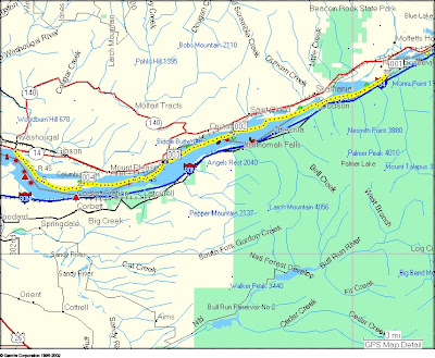
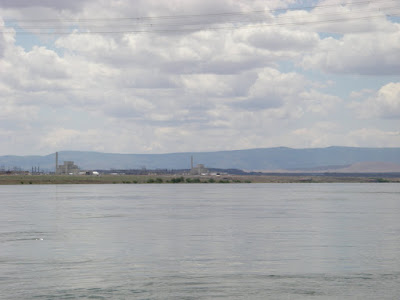
We stopped for lunch at the point where the river bends to the south (see map). Yep, still sunny.

After lunch we paddled pretty much south along the White Bluffs. Beautiful scenery, and very different than the Lower Columbia where I paddle so often. Kayaking in the desert, a nice change.


As we got closer to our take out a S wind kicked up against us, making us work a bit for the first time that day. Since the wind slowed me down I was able to really focus on various aspects of my forward stroke using the Greenland paddle.

We got the the take out, which is one end of an old ferry route, got boats and gear packed up, and we all headed for home. A really nice day on the river!

On the water: 11:05
Off the water: 15:50
Distance: 18.4 nm
Max speed 11.1 kt
Average speed 4.9 kt

Sunday, May 25, 2008

Tenasillahe Island May 2008


Date: 5/25/2008
Time on water: 12:40
Time off water: 15:50
Trip distance: 5.36 nm
max speed 5.5 kt
moving avg: 2.7 kt
moving time: 2 hrs


I took Stephanie to Skamokawa for a kayak class with Columbia River Kayaking. She had come to Alder Creek's PaddleFest in April and really enjoyed kayaking so wanted to take a class to build a good foundation for having fun and being safe kayaking. And depending on conditions I would find some fun place to paddle while she was taking the class.

Due to warm weather the week before and alot of recent rain the water level of the Columbia was pretty high. It rained for most of the drive up to Skamokawa, but soon after we got there the rain stopped. I introduced Stephanie to Ginni. It was good to see Ginni again. Back from Mexico she was nicely tanned :)

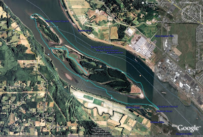
I helped Stephanie sort out a bit of gear and clothing and I looked at the water and the charts to figure out what I was going to do with the day. Though the water was high, it didn't look brown and churning. Low tide was appr 13:30, but the current was basically ebbing all the time I would be out. So I planned to paddle across the river to Welch Island and Tenasillahe Island. The idea was to allow the current to take me downstream a bit to the north end of Welch Island. Then I'd paddle upstream in the shallow water near the islands as far as I had time. Then back across the main channel to the Washington side where the current would be stronger and let that strong current take me back to Skamokawa.

I got setup and headed out. Once I got into the shipping channel it was clear that there was alot of current. I basically followed my plan and ended up at the north end of Welch Island for lunch. Then paddled upstream, found the shallow water at the south end of Welch Island, crossed Red Slough over to Tenasillahe Island where I stopped for a hike on the trail around the perimeter of the island. I paddled a bit further south along Tenasillahe Island and headed back across the main channel. Once I'd crossed the shipping channel I turned downstream to enjoy the pretty strong current spiriting me back to Skamokawa.

Along the way I saw a few blue herons, alot of ospreys hunting, a bald eagle on Price Island eating something with a number of vultures hanging out nearby just waiting...

I got back to Skamokawa Center and found that Stephanie's class had just come ashore and were doing navigation stuff in the classroom. After her class, Stephanie and I headed over to the River Rat in Cathlamet to toast the day! It sounded like she had a great class and a good day on the water as well.

Tuesday, April 15, 2008

Circumnavigation of Lord and Walker Islands


On a pleasant Sunday in mid-April an intrepid band of OOPS paddlers kayaked around Lord and Walker Islands (in the Columbia River near Longview).

This was an OOPS trip. Joanne Barta organized the trip and was one of the leaders. Don Beale and Ken Durbin were co-leaders. There were 11 of us total. The plan was to meet at Dibblee Beach on the Oregon side of the Columbia River at 9am and be on the water by 10am, paddle downstream in the main channel taking advantage of the current, have lunch at the north end of Walker Island, and return to Dibblee Beach upstream via the slough on the Oregon side. High tide in Longview was at appr 9:40 and the next low tide was at appr 18:40, so we'd be paddling on an ebb the entire trip.

The weather prediction was chance of showers, winds W - NW 7 - 10 mph.

After everyone got their gear ready and we talked about the plan for the day and safety we got on the water at 10:10.

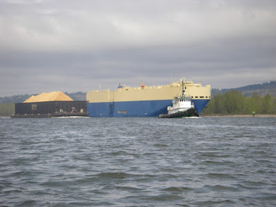
The day started off overcast and cool, with very little wind, but it looked like we could get some showers. We headed out into the main channel of the Columbia and it was easy paddling with the current. We watched a freighter pass a tug pulling a barge. Looked like a very slow-motion drag race.


The day had warmed up a bit by the time we stopped for lunch at the north end of Walker Island. We had a very nice lunch stop. We even had entertainment! Joanne was practicing throwing her harpoon and then giving others who wanted to try it a bit of instruction.


After lunch we meandered in the wetlands of Lord Island. Very pleasant paddling. We saw eagles, ospreys, geese and lots of different ducks. We stopped for a bit to stretch our legs and Joanne and Don showed us that you don't need to be near dry land to do that!


The paddle back to Dibblee Beach gave us a nice bit of exercise paddling upstream. That promised west wind never did really get very strong so not much wave action at all. Since the day was so nice we took some time to practice towing. The water was still pretty cold so folks weren't too enthusiastic about practicing rescues quite yet :) But some of us did practice our rolls just before getting back to the beach. And it never did end up raining :)

All in all a very pleasant day paddling and hanging out with a good group of folks.

Date: 4/13/2008
On the water: 10:10
Off the water: 15:40
Total: 9.9 nm

(Click on any of the photos for larger versions.)

Thursday, April 10, 2008

Scappose Bay


On a mild Saturday in late March, Kristin and I explored the Scappoose Bay waters. Our goal was to get out and do some mellow wetland paddling. Due to time constraints we also needed somewhere relatively close to town so we chose Scappose Bay.

We put in at the Scappose Bay Marina about two hours before low tide. Since the water was ebbing, we first paddled out of Scappoose Bay, across Multnomah Channel, and up the little river flowing out of Sauvie Island across from Scappoose Bay. Then, as the tide was beginning to flood, we paddled back in to Scappoose Bay to explore its wetlands as they filled with water.

Well, they weren't filling up very fast so we found ourselves paddling in about 12 inches of water alot of the time. We were thus thankful we were paddling kayaks. It was a beautiful spring wetland paddle where we saw alot of birdlife: geese, including some beautiful white ones, ducks, herons, etc. And we startled alot of carp in the shallow water.

Date: March 22, 2008
Appr 8.5 miles.

Sunday, March 9, 2008

Bonneville Dam to Washougal


Well, another sunny day paddling with Jon Walpole and friends.

Jon was looking for a nice kayak trip for this Sunday. The Columbia Gorge was an option. The weather prediction for today in the Columbia Gorge was for E winds 11-17, gusting to 25 (mph). 20% chance of rain. Though the tidal influence at Bonneville is small, the tide would be ebbing all the time we'd be paddling. (High tide Vancouver: 9:23am, low 17:39.) Not bad. So he planned a trip from Bonneville Dam to Washougal. I'd never paddled that part of the Columbia so I was definitely up for it.

Jon, Jenny and I met at Steamboat Landing in Washougal at 9am (a civilized time - I'd even had time for coffee and breakfast). We took Jon's car up to the boat ramp on Hamilton Island for our launch. As we drove to the boat ramp we got an awe-inspiring view of massive amounts of water coming over the Bonneville Dam spillway. Now, I'd never been to this spot... but the boat ramp seemed awfully close to the dam's spillway if you ask me. And the really big red sign just a few feet east of the boat ramp that said something like "Danger - Do not proceed past this point" also was pause for reflection. Still, we got gear situated, did warm up exercises, etc. As we were getting ready pair of bald eagles flew by. A good omen to be sure.

The boat ramp itself runs into a little eddy. We launched, and leaving the eddy into the main channel turned out to be a very pleasant little bit of acceleration to start our voyage and not the Deception Pass eddy peel-out I was expecting. We got on the water at 10:20.

On the chart it's clear that the Columbia is pretty narrow at that point, but it was striking to actually be there. It really feels narrow. And alot of water moving. We were paddling gently yet cruising along at a nice rate of knots. In that area of strong current we were often going 10 mph: 8.7 kt! I was thrilled.

We did a bit of eddy play here and there. Some impressive eddylines. Not Deception Pass, but alot more conveniently located!

Of course the river soon widened and the current slowed to pretty much what you'd expect -- appr. 2 kt. We got more current here and there, but never got going that fast again on this voyage.

During the early part of the trip there was next to no wind. So the current was a great help. After awhile the wind picked up, but it never got to the promised 17 mph and I'm sure I never felt a 25 mph gust. But the wind did pick up to appr 15 mph and we got some small waves. These small waves were great for practice. Trying to eek as much energetic help from them as I could. And lots of opportunities for really working on getting my speed right for catching a wave, stern rudder, etc.

We stopped for lunch on Skamania Island. Jon and I told Jenny stories about hiking and climbing in Scotland. The sun baking down :)

After lunch the 15 mph E wind was still helping us. We continued to work on catching those small waves. We planned to pull into the eddy behind Phoca Rock to relax. But as we approached we saw that there were at least ten sea lions hauled out on the rock. As we passed they clearly weren't happy with us. My they can be noisy! And big! And about the time we were going to pull into the eddy behind Phoca Rock the all jumped into the water. I was sure they were heading for us! So... we didn't pause there. Where are the orcas when you need 'em?

We meandered at the base of some beautiful basalt cliffs at Cape Horn. Some nice waterfalls. Some nice spots to play among the rocks.

We did pause for a break at the east end of Reed Island. Then off for the final bit back to Steamboat Landing. As we neared Washougal the wind died completely and it felt like summer. We made use of the calm water to practice paddling in reverse for awhile. Always good to do.

Then were were back just before 4pm. A total of 19.33 nm -- 22.3 miles! Our moving average speed was 4.2 kt across the entire day. Max speed: 9.7 kt :) Moving time: 4hr 32min.

Easily the most distance I've ever covered paddling on a day trip. And I felt great at the end of the day. I've definitely had days when I was much more tired after not covering as much distance - like every BCU 4 star training I've had the good fortune to take (a heartfelt thank-you to Shawna and Leon and Karl and John Wallum).

What a great day. We had beautiful weather. Great company. The current helped us out. We saw eagles and a falcon of some variety. More sea lions that I'd care to.

But bittersweet at the end... got back to the car and had a voice message from my Uncle Lou's partner. My Uncle Lou, a fellow kayaker, is in his 80's and has been getting alot weaker lately. His partner phoned to tell me he's not likely to live to the end of the month. His heart is just giving out. He hasn't been out kayaking in some years now, but was very encouraging when I took it up and has enjoyed my trip reports. He always wants more details when we talk on the phone. I know we all get old, but I will miss him.

As usual, click the picture below for more pictures. Jenny took most of the good ones!

Saturday, February 23, 2008

Astoria to Knappa


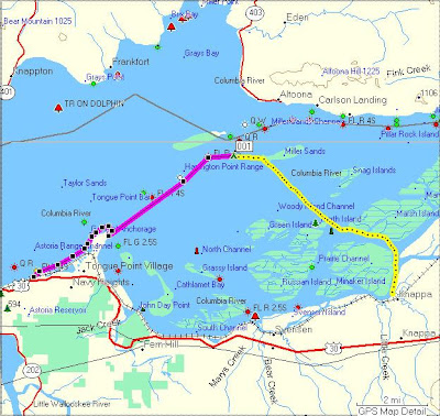
On a sunny Saturday in February a group of kayakers paddled from Astoria to Knappa Oregon via Miller Sands. There were seven of us: Jon and Kirti, Ron and Jodi, Jenny, Melody and I.

Jon Walpole planned this trip. The idea was to enjoy the open water on the lower Columbia and get a more "sea kayak" feel for the trip by paddling out to Miller Sands. The plan was to start in Astoria and use the flood current to help us on our way to Miller Sands and thence to Knappa. The flood started appr 11:30 in Astoria (Tongue Point) and slack before ebb was at appr 3pm and closer to 4:15 near Knappa. Winds were predicted to be SE 6 - 11 mph shifting to NE. Weather was predicted to be showers in the morning, clear the rest of the day. So a pretty good forecast for a day out on the Columbia.

We got on the water at appr 11:40. The day was clear and there was a good breeze blowing at the East Basin Boat Landing where we set off (appr 10 - 12 kt). Our plan was to round Tongue Point and pause to re-evaluate once we saw what the winds were like for the more open water part of our trip. If the winds were too strong we could choose to meander through the sloughs to get to Knappa, or of course turn back if need be.

The current was already flooding when we set off. We made good time to Tongue Point. The winds weren't bad at all. We rounded the point and stopped for a few minutes to do a bit of navigation to determine what landmarks we would use to paddle to Miller Sands. I'd never been to Miller Sands and at that distance I couldn't see them. I could take a compass bearing, but couldn't see where the west end of the sands were. I could see Rice Island and the SE part of Miller Sands that has trees. We figured out points we could use for navigation and set off on our crossing to Miller Sands.

The crossing felt great. It did have a very "open water" feel about it. But since the weather was so nice we didn't have much in the way of waves. Very pleasant paddling. A beautiful day, a light breeze, sometimes very small waves. The flood current definitely helped us. Jon felt that we were sometimes moving along at over 4 kt.

We had lunch on Miller Sands under a blazing February sun. After lunch we paddled over to the large part of Miller Sands (the part with the trees) and did a bit of navigation to figure out landmarks for our crossing to the islands near Knappa. Another very pleasant crossing over to Marsh Island and Karlson Island. I finally remembered to turn on my GPS at lunchtime -- we paddled this leg of the trip at just a hair over 3 kt -- which we we knew at the time because we timed how long it took to get to a navigation marker at Marsh Island. (NB: On the map above I drew the first part of the route by hand where I didn't have the GPS on.)

We then paddling along a few beautiful and relaxing sloughs to Knappa. The tide was high so the main sloughs were wide and the islands were full of little channels.

Along the way we saw I think 7 bald eagles, a couple herons, and at one point flock of hundreds of ducks took off ahead of us making a sound like a thousand shower heads raining down on the water. Just stunning.

We got off the water just before 5pm. A very nice day of paddling. 12.5 nm

For more pictures click photo:

Wednesday, January 23, 2008

County Line Park to Cathlamet January 2008


On a sunny Monday in January Jon Walpole led a group of paddlers on a trip on the lower Columbia. We paddled from County Line Park (imaginatively near the county line between Cowlitz County and Wahkiakum (We-kayak-um) County) to Cathlamet. Slack before ebb was at about 1pm. The plan was to put in a bit before slack (somewhere between 11am and noon). An east wind would also propel us westward toward Cathlamet, perhaps giving us some waves to surf.

The weather prediction was for cold (high 38 F) and windy: 17 mph east wind gusting to 25 mph. Brrr! And indeed when we met the rest of our paddling team at Alder Creek Kayak parking lot bright and early this morning it was clear and a cold east wind was blowing, and we were cold in that parking lot there just shuffling boats around.

We drove to County Line Park (can’t people come up with better names for nice parks???), turned into the park, and magically slipped into an alternate universe. We got out of the cars and there was no wind. It was clear. The sun was baking down. We were warm!

Some folks shuttled a few cars down to Cathlamet Marina (our destination) and noted that near Cape Horn the wind was indeed blowing as predicted. Well, we weren’t surprised.

But at least when we started the trip we were warm and basking in a beautiful January day on the river. What luck! So on we paddled downstream in calm air and slack tide.

Just before Cape Horn (where the wind starts) we found a nice beach. We stopped for lunch to enjoy the last of the warm day with no wind. It was beautiful.

Then off for adventure! We got to Cape Horn and… no wind. Well, maybe 3 – 4 kt east wind. And by now it had turned into an ebb tide. So we had a (very) light breeze at our backs and a gentle current taking us downstream toward Cathlamet. And it stayed calm all day. Amazing.

We crossed over to Puget Island and paddled among the sloughs on the east end of the island (near Ginni's farm). We saw eagles and herons and seals, oh my.

We crossed back over to the Washington side of the Cathlamet Channel to view the waterfalls along the cliffs and avoid the breeze that was now picking up just a bit. Watched the sun set over the hills on the Oregon side and saw the full moon rise over Cathlamet.

12.6 nm.


Pictures at:
http://picasaweb.google.com/jaybuckingham/CountyLineParkToCathlametJanuary2008


Skamokawa November 2007


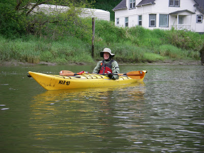
Pleasant day of paddling with Kristin, Katlyn and Breanna. Rented boats for the girls from Skamokawa Center. (Well, Katlyn ended up paddling my Romany.) Paddled lazily down Steamboat Slough and back, then up Skamokawa Creek a bit and back.

It was a very high tide that day. We started paddling on the flood and returned to Skamokawa Center along Steamboat Slough for lunch as it began to ebb. After lunch our short paddle up Skamokawa Creek was on the ebb. Still not much current so not much work to paddle upstream. A very easy paddle back to Skamokawa Center. A bit of wind out on the Columbia (maybe 10 kt) so to make things easier for the girls we stayed in sheltered areas.
11/24/07. Appr 5.5 nm

Tuesday, January 22, 2008

Lower Columbia near Clatskanie

Training for LoCo Roundup. An appr 10 nm trip from Clatskanie City Park to the island just outside of Wallace Island (on the way to Eureka Bar). Perfect weather. We went out at the end of the ebb and came back during flood. Very pleasant paddling. 8/19/2007.

Sunday, January 6, 2008

Clatskanie to Eureka Bar August 2007


Another camping trip on Eureka Bar. This time in the summer. After camping out here in December I was really able to appreciate hanging out barefoot in the sand with the sun baking down! Camped for two nights with Craig, Chrissy, Danny, Marlen and Michael in August 2007.

I paddled from the Beaver Boat Ramp in Clatskanie out to the island. An easy trip on the way to the island (quite calm) (8/2/07). On the return trip (8/4/07) I encountered 15 kt winds and 2 - 3 ft wind waves. 5.6 nm each way.

Saturday, January 5, 2008

Clatskanie to Eureka Bar December 2006


I camped on Eureka Bar between Christmas and New Year 2006 with Craig, Todd, Ian and their friends. They have a tradition of camping on this island near Clatskanie between Christmas and New Year and they invited me this year. Craig loves being on the water any time of year and has taken his boys out camping, backpacking and boating for years. They have a great shelter setup on the island, which is great for these winter trips.

I love the austere feel of being out in nature in the winter. And the camraderie of camping with the guys was great. We ate well, kept warm in front of the fire, and told good stories.

I paddled there from Clatskanie. Easy paddling in the Clatskanie River. But definitely windy on the Columbia: appr 15 kt winds. 5.6 nm each way.

Friday, January 4, 2008

Skamokawa to Hunting Island October 2006

Paddled with Kristin from Skamokawa to nearly Cathlamet in October 2006. We paddled on Steamboat Slough and Elochoman Slough with about a mile on the Columbia. A very nice fall day. Started off calm, but near the end of the afternoon a SW wind picked up to 15 - 20 kt, with 2 ft wind waves. 8.6 nm